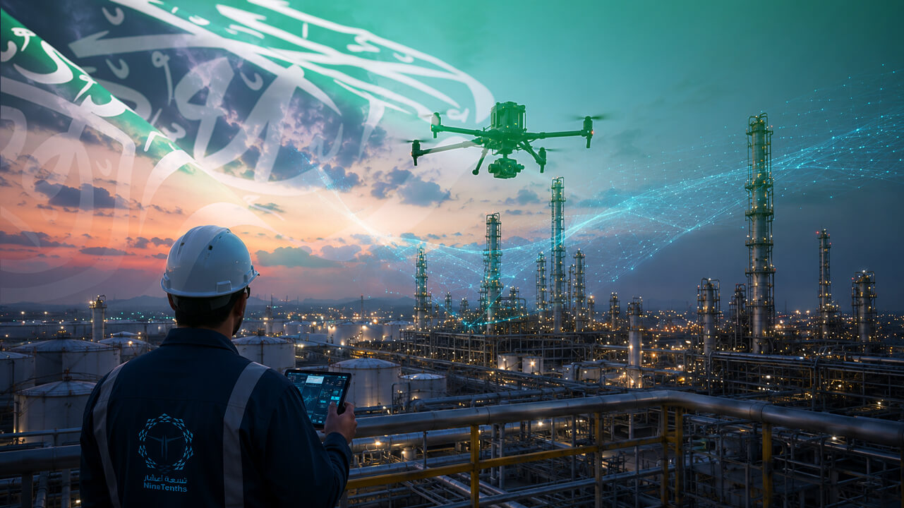
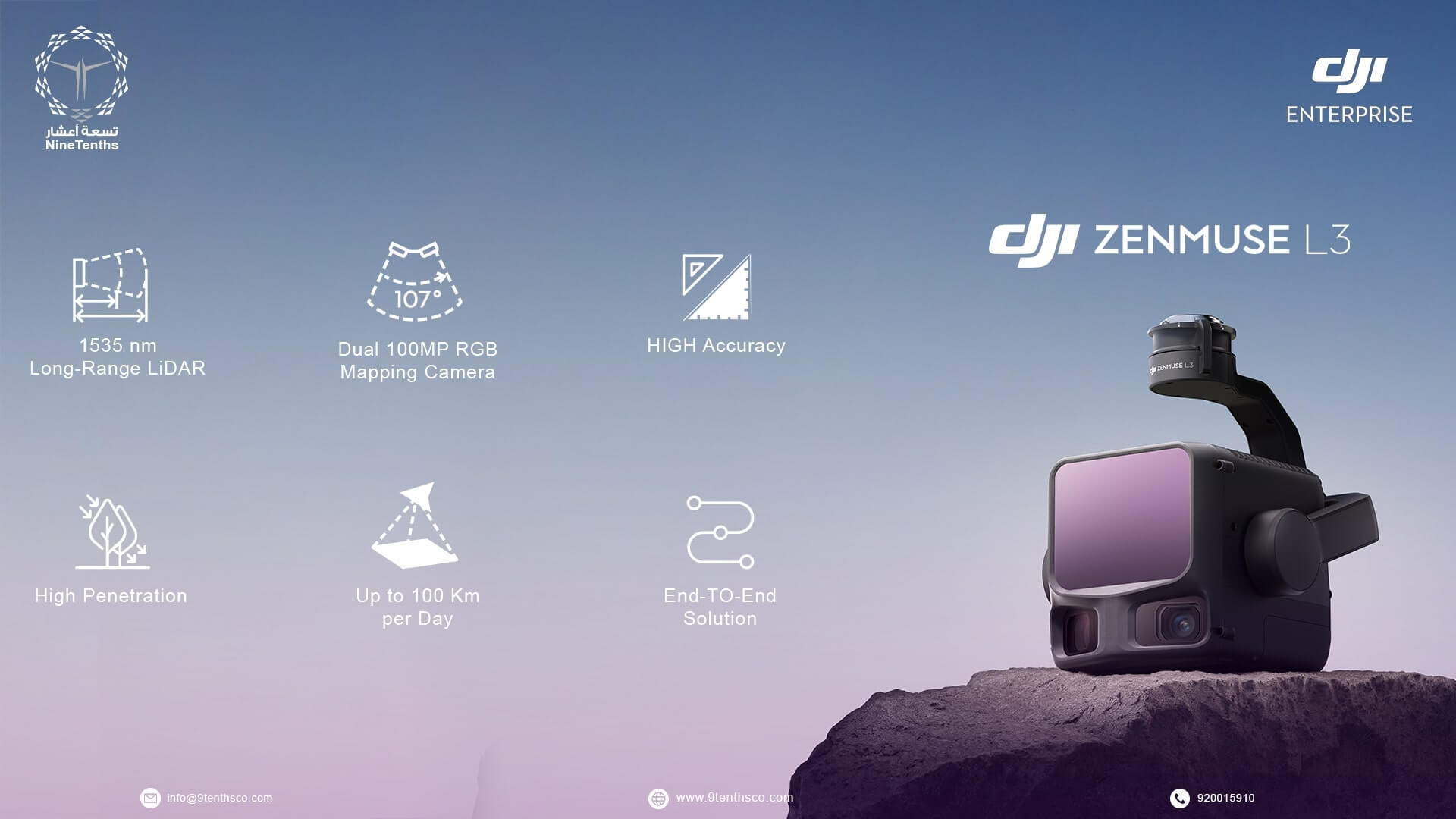
The DJI Zenmuse L3 marks a new chapter in professional LiDAR mapping. Built for experts who rely on precision data, it combines extended range, high-density point clouds, and superior accuracy — delivering consistent results even in demanding environments.
At NineTenths, we believe the true power of drone-based LiDAR lies in how efficiently it turns complex terrain into meaningful, measurable insights. With the L3, that transformation is faster, smarter, and more integrated than ever.
Table of contents
- Built for Precision and Performance
- True Integration of LiDAR and RGB
- Real-Time Situational Awareness
- Strong Performance in Tough Environments
- Simplified Workflow from Capture to Output
- Smarter Operations, Better Outcomes
- How DJI Zenmuse L3 Works in Aerial Mapping Projects
- Summing Up:
- Frequently Asked Questions About DJI Zenmuse L3
Built for Precision and Performance
The Zenmuse L3 brings a redesigned LiDAR module that captures high-density point clouds at impressive speed and detail. Its upgraded IMU and improved synchronization with the onboard RGB camera result in cleaner, more accurate datasets straight out of the flight.
What this means in the field is fewer re-flights, faster data capture, and more confidence in every survey. The sensor performs well even over reflective or uneven surfaces — a big plus when working on roads, quarries, or mixed terrain.
True Integration of LiDAR and RGB
The L3 combines LiDAR and RGB imagery more seamlessly than before. Every point cloud can be automatically colorized with real imagery, producing accurate and visually rich 3D models.
This helps not just with analysis but also with communication — when clients or engineers can see what the terrain looks like in realistic detail, decision-making becomes much faster.
For applications like construction monitoring, stockpile measurements, or environmental mapping, this combination is particularly effective.

Real-Time Situational Awareness
One of the biggest advantages of the L3 is real-time 3D visualization in DJI Pilot 2. Operators can view the live point cloud during flight, ensuring full coverage of the survey area before landing.
This immediate feedback saves valuable time, especially during tight field schedules or in remote areas where returning for a reflight isn’t easy.
Strong Performance in Tough Environments
The L3 is built to perform in real conditions — from hot desert environments to low-light forest canopies. Its high accuracy and strong return signal make it suitable for a wide range of operations:
- Mining – detailed pit and stockpile volume analysis
- Transmission line inspection – identifying vegetation encroachments and structural clearance
- Forestry and environmental mapping – measuring canopy density and terrain beneath vegetation
- Infrastructure and road projects – generating accurate surface and alignment models This versatility makes it one of the most capable payloads for professional-grade UAV mapping.
Simplified Workflow from Capture to Output
The L3 fits smoothly into existing DJI software like DJI Terra and DJI Modify, covering the full data workflow from acquisition to modeling. Processing LiDAR data, classifying terrain, and generating digital elevation models can now be done in a few straightforward steps.
For teams used to managing multiple software platforms, this level of integration translates directly into efficiency and reduced turnaround time.
Smarter Operations, Better Outcomes
In practice, the L3 allows teams to fly longer, capture more, and process faster — all with a higher level of confidence in the final results. Whether for large-scale industrial projects or detailed environmental studies, it combines the endurance of the Matrice 400 RTK with the precision of next-generation LiDAR.
At NineTenths, tools like the L3 play a key role in how we continue to enhance our aerial mapping and inspection services. They allow us to deliver accurate, actionable data while keeping operations efficient and adaptable to client needs.
How DJI Zenmuse L3 Works in Aerial Mapping Projects
How DJI Zenmuse L3 Works in Aerial Mapping Projects
- Flight Data Collection
The Zenmuse L3 collects geospatial data during drone flight using advanced LiDAR scanning technology.
- Dual Data Capture (LiDAR + RGB)
It captures laser-based distance measurements while simultaneously recording RGB imagery for colorized 3D mapping.
- Real-Time Monitoring
Operators monitor mission progress in real time using DJI Pilot 2 to ensure complete area coverage.
- Data Processing Workflow
After flight, the collected data is processed in DJI Terra or compatible software to generate 3D models and elevation maps.
- Final Output Delivery
The processed results are used for surveying, mapping, infrastructure analysis, and environmental studies.
Summing Up:
The Zenmuse L3 isn’t just an upgrade in specifications — it’s a smarter way of collecting 3D data. Its precision, reliability, and real-time awareness make it a powerful asset for professionals who depend on trustworthy LiDAR outputs.
As drone technology continues to evolve, systems like the L3 are setting new standards for what’s possible in the field — and at NineTenths, we’re ready to bring those capabilities directly to our clients’ projects.
The Zenmuse L3 redefines what’s possible in aerial LiDAR mapping — and NineTenths makes sure you get every advantage from it.Let’s turn cutting-edge technology into real-world results.
Frequently Asked Questions About DJI Zenmuse L3
DJI Zenmuse L3 is used for high-precision aerial LiDAR mapping, 3D terrain modeling, and professional surveying applications.
It uses LiDAR laser scanning combined with RGB imaging to collect accurate 3D geospatial data during drone flights.
It is widely used in mining, construction, infrastructure inspection, forestry, and environmental mapping projects.
It features advanced LiDAR technology, upgraded IMU systems, and precise data synchronization for high-quality point cloud outputs.
Yes, it merges LiDAR scanning with RGB imagery to create colorized and highly detailed 3D models.
It is compatible with DJI Terra and DJI Modify for processing, analyzing, and generating 3D mapping outputs.
Yes, operators can monitor live point cloud data during flight using DJI Pilot 2 for full mission awareness.
Need high-precision LiDAR data for large-scale mapping and complex environments?
Contact NineTenths today to discover how the DJI Zenmuse L3 delivers powerful long-range scanning, dense point clouds, and faster data acquisition to support smarter surveying and geospatial decision-making.