Estimated reading time: 6 minutes

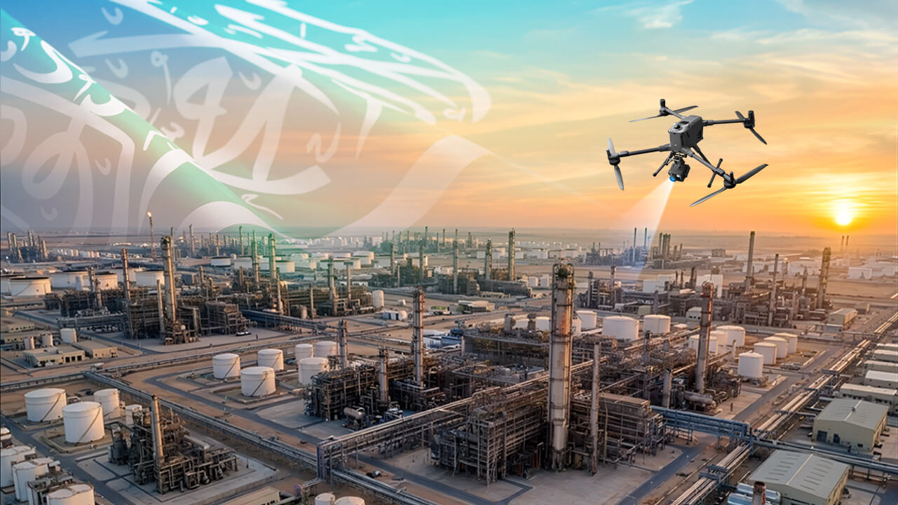
Aerial inspection is evolving with the DJI M350 RTK, integrating LiDAR and RGB cameras to deliver highly accurate, safe, and efficient data collection for industries in Saudi Arabia. NineTenths leads this transformation by providing advanced drone-based inspection solutions aligned with Vision 2030.
Industries in Saudi Arabia are undergoing a revolutionary transformation in inspection processes, thanks to cutting-edge drone technology. NineTenths is at the forefront of this evolution, providing innovative aerial solutions that redefine industry standards while supporting the goals of Vision 2030.
Technology is driving unprecedented change, aerial inspection stands at the forefront of innovation. The integration of LiDAR (Light Detection and Ranging) and RGB (Red, Green, Blue) cameras is transforming how industries monitor, analyze, and maintain critical infrastructure and environments. The DJI M350 RTK, equipped with the Zenmuse L2 for LiDAR and Zenmuse P1 for RGB imaging, is setting new benchmarks in data acquisition and analysis.This article explores how this cutting-edge technology is shaping the future of aerial inspection and unlocking new possibilities across various sectors.
Table of contents
- The Evolution of Aerial Inspection
- DJI M350 RTK: The Ultimate Inspection Platform
- Why Choose the DJI M350 RTK for LiDAR and RGB Integration?
- Benefits of LiDAR and RGB Integration
- How to Conduct Advanced Aerial Inspection Using DJI M350 RTK
- Applications Driving the Future:
- Challenges and Future Opportunities :
- Summing Up:
- Frequently Asked Questions About Aerial Inspection with DJI M350 RTK
The Evolution of Aerial Inspection
Traditionally, inspections of infrastructure such as bridges, power lines, and pipelines required significant time, manpower, and resources. With the advent of drones equipped with advanced sensors, the process has become more efficient and safer. The combination of LiDAR and RGB cameras takes this efficiency to the next level, delivering unparalleled accuracy and comprehensive data.
DJI M350 RTK: The Ultimate Inspection Platform
The DJI M350 RTK is a robust and reliable aerial platform designed for precision tasks. Its versatility and high-performance capabilities make it ideal for industries like construction, energy, and environmental conservation.
Zenmuse L2: Revolutionizing LiDAR Technology

The Zenmuse L2 transforms the DJI M350 RTK into a LiDAR powerhouse, offering unmatched precision in topographic mapping, forestry management, and infrastructure modeling. It generates highly accurate 3D point clouds, even in challenging environments with dense vegetation or complex terrains.
Zenmuse P1: Redefining RGB Imaging
The Zenmuse P1 enhances the capabilities of the M350 RTK with high-resolution, true-color imagery. This RGB camera captures photorealistic visuals that provide critical context to LiDAR data, enabling industries to create detailed and actionable 3D models.
Why Choose the DJI M350 RTK for LiDAR and RGB Integration?
- Enhanced Accuracy: The combination of LiDAR and RGB imaging ensures precise measurements with detailed visual context, perfect for demanding projects.
- Comprehensive Data Collection: The Zenmuse L2 and P1 work in tandem to capture geometric and visual data, offering a complete view of assets.
- Improved Efficiency: The DJI M350 RTK covers vast areas quickly, reducing operational costs and time while enhancing safety by minimizing manual inspections.
- Versatility Across Applications: From inspecting bridges and solar farms to precision agriculture and disaster management, this integrated system adapts seamlessly to diverse industry needs.
Benefits of LiDAR and RGB Integration
1. Enhanced Accuracy
The fusion of LiDAR and RGB data ensures precise measurements and detailed visual context. This is particularly critical for industries like construction and surveying, where accuracy is paramount.
2. Comprehensive Data Capture
LiDAR captures structural details, while RGB cameras provide color and texture information. Together, they deliver a holistic view of assets, enabling better decision-making.
3. Improved Efficiency
Aerial drones equipped with LiDAR and RGB cameras can cover large areas quickly, reducing the need for manual inspections and cutting operational costs.
4. Safer Operations
Inspections in hazardous environments, such as high-voltage power lines or unstable terrains, can be conducted remotely, ensuring the safety of personnel.
5. Applications Across Industries
This integrated approach is adaptable to various sectors:
- Infrastructure: Detailed inspections of bridges, roads, and buildings.
- Energy: Monitoring of solar farms, wind turbines, and power lines.
- Agriculture: Precision farming through crop analysis and field mapping.
- Forestry: Assessment of forest health and biomass estimation.
How to Conduct Advanced Aerial Inspection Using DJI M350 RTK
How to Conduct Advanced Aerial Inspection Using DJI M350 RTK
- Step 1: Define Inspection Objectives
Identify whether the project involves infrastructure, energy, or environmental inspection.
- Step 2: Select Proper Payloads
Use LiDAR (Zenmuse L2) for 3D mapping and RGB (Zenmuse P1) for visual documentation.
- Step 3: Plan Flight Missions
Design automated flight paths to ensure full coverage and data accuracy.
- Step 4: Capture and Process Data
Collect LiDAR and RGB data and process it into 3D models and inspection reports.
- Step 5: Analyze and Report Findings
Use processed data to detect issues, assess conditions, and support decision-making.
Applications Driving the Future:
1. Smart Cities
As urban areas adopt smart city initiatives, LiDAR and RGB integration will play a crucial role in urban planning, infrastructure monitoring, and traffic management.
2. Environmental Conservation
From mapping endangered habitats to monitoring climate change impacts, this technology supports sustainable practices and informed decision-making.
3. Disaster Management
Post-disaster assessments can be expedited with accurate 3D mapping, enabling faster recovery and resource allocation.
Challenges and Future Opportunities:
While the integration of LiDAR and RGB cameras offers immense benefits, challenges such as high initial costs and data processing requirements remain. However, advancements in drone technology, cloud computing, and AI-powered analytics are addressing these issues, making the technology more accessible and efficient.
Summing Up:
As industries embrace digital transformation, the DJI M350 RTK, with its advanced payload options, is at the forefront of innovation. It empowers businesses to make informed decisions, enhance safety, and optimize resources for sustainable operations.
Whether you’re planning infrastructure assessments or environmental conservation projects, the DJI M350 RTK equipped with Zenmuse L2 and P1 is your ultimate partner in aerial inspection excellence.
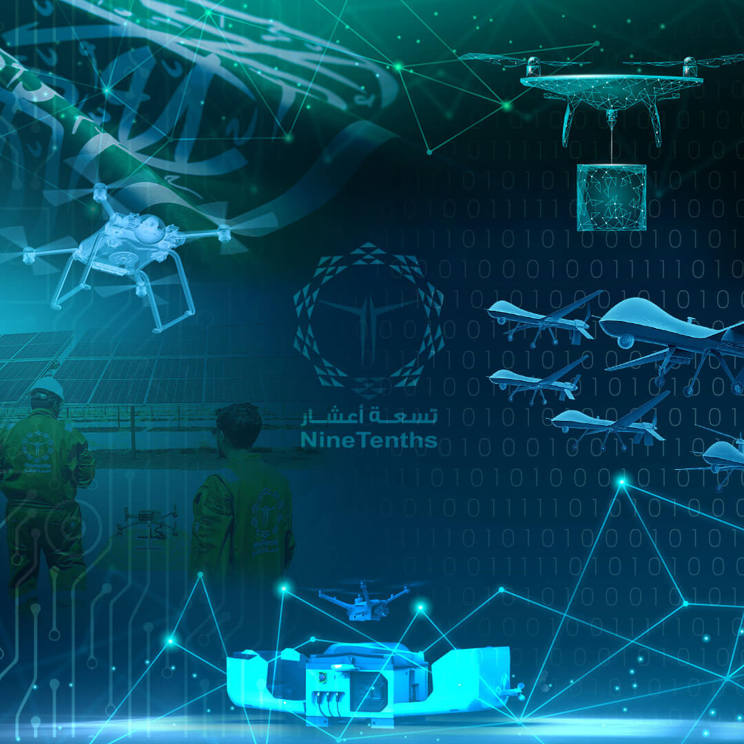
Supporting Vision 2030
NineTenths leverages advanced drone systems like the DJI M350 RTK to align with Saudi Arabia’s Vision 2030. By combining innovation, safety, and cost-effectiveness, we empower industries to adopt smarter, more sustainable operations.
As Saudi Arabia continues to lead in adopting advanced inspection technologies, NineTenths remains committed to driving growth and efficiency through its expertise in drone-based solutions.
Whether your focus is on infrastructure development, renewable energy, or environmental management, NineTenths offers a powerful platform to elevate your operations with unmatched precision and efficiency.
Frequently Asked Questions About Aerial Inspection with DJI M350 RTK
Aerial inspection is used to monitor infrastructure, energy systems, agriculture, and environmental assets.
It provides high precision data using LiDAR and RGB cameras for accurate analysis.
LiDAR creates detailed 3D point clouds for precise mapping and structural analysis.
Yes, it reduces the need for human exposure to dangerous environments.
Construction, energy, oil and gas, agriculture, and environmental sectors.
Looking to enhance your inspection and surveying operations?
Contact NineTenths to learn how LiDAR and RGB drone solutions provide accurate 3D data, detailed visual analysis, and safer inspections across critical infrastructure.