Estimated reading time: 5 minutes
In a landscape where precision, reliability, and operational efficiency define success, DJI’s Matrice 400 RTK sets a new benchmark. Engineered for demanding industrial and geospatial operations, this next-generation drone is redefining what’s possible in aerial data capture.
At NineTenths, we are proud to offer the M400 RTK to our clients across Saudi Arabia and the wider GCC region—enabling smarter workflows, safer inspections, and faster results.
Table of contents
- Built for Harsh Environments
- Key Dimensions:
- Endurance That Redefines Mission Time
- Performance Without Compromise
- Payload Ready, Multi-Mission Capable
- How to Operate DJI Matrice 400 RTK for Industrial Missions
- Ready for the Future
- Why NineTenths?
- Summing Up :
- Frequently Asked Questions about DJI Matrice 400 RTK
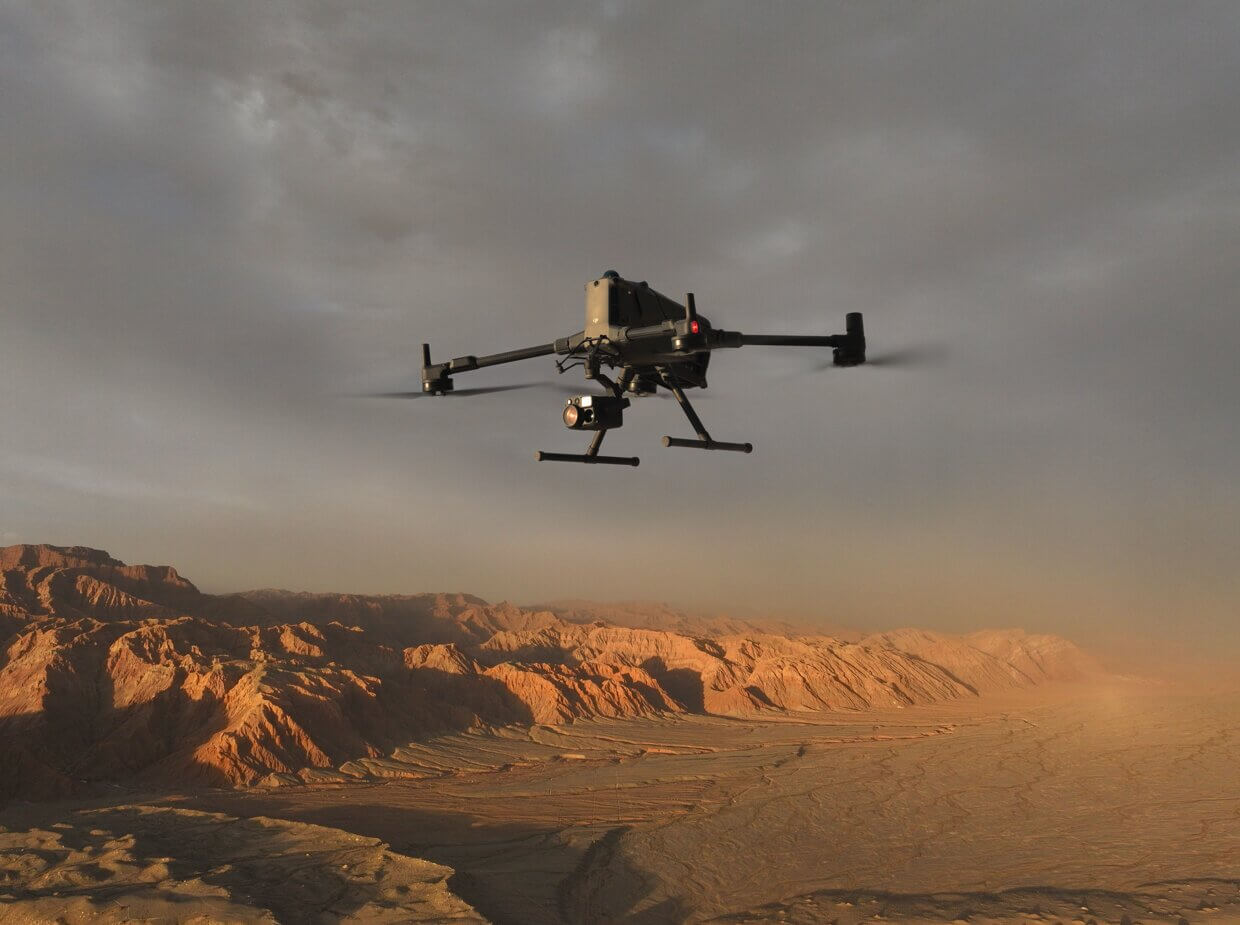
Built for Harsh Environments
The Matrice 400 RTK is designed to thrive where others hesitate. It features an IP55 rating, providing strong protection against dust and water. Its robust body, paired with high wind resistance of up to 12 m/s, makes it ideal for operations in rugged, high-stakes environments— from deserts to coastal zones.
Key Dimensions:
- Unfolded: 980 × 760 × 480 mm (L × W × H)
- Diagonal Wheelbase: 1070 mm
- Propeller Size: 25 inches
Endurance That Redefines Mission Time
Efficiency matters when you’re mapping vast tracts of land or inspecting critical infrastructure.
The M400 RTK delivers:
- Max Flight Time: 59 minutes (no wind)
- Max Hover Time: 53 minutes
- Flight Range: 49 km
- Max Payload: 6 kg (excluding batteries)
- Max Takeoff Weight: 15.8 kg
Hot-swappable TB65 intelligent batteries keep downtime to a minimum. Paired with the BS65 battery station, your fleet stays charged and ready.
Performance Without Compromise
Powered by DJI’s O3 Enterprise Transmission, the M400 RTK provides:
- Transmission Distance: Up to 20 km (CE standard)
- Max Horizontal Speed: 25 m/s
- Max Altitude: 7000 m
- Ascent Speed: 10 m/s
- Descent Speed: 8 m/s
These metrics translate to faster deployments, longer reach, and smoother control—making it perfect for large-scale corridor mapping, line inspections, or emergency response.
Payload Ready, Multi-Mission Capable
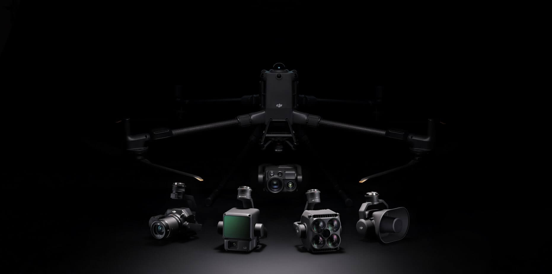
The Matrice 400 RTK supports a wide ecosystem of payloads including:
- Zenmuse H30 Series – For night vision, optical zoom, thermal, and laser rangefinding
- Zenmuse L2 LiDAR – For 3D mapping and terrain modeling
- Zenmuse P1 – For ultra-high-resolution photogrammetry
- Third-party payloads – Via Payload SDK for specialized applications
Its dual downward gimbal support and top-mount option allow you to customize it for your mission—be it search & rescue, topographic survey, or asset inspection.
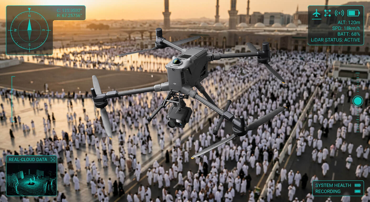
Intelligence That Makes a Difference
The M400 RTK is not just powerful; it’s smart. Through the DJI Pilot 2 app, you can automate and optimize your workflow with:
- Smart oblique capture for 3D modeling
- AI spot checks for repeat inspections
- Terrain following for topographic accuracy
- Waypoint-based mission planning
With RTK-level accuracy and six-directional obstacle sensing, each flight is safe, efficient, and repeatable.
How to Operate DJI Matrice 400 RTK for Industrial Missions
How to Operate DJI Matrice 400 RTK for Industrial Missions
- Mission Planning
Plan flight routes using DJI Pilot 2 or compatible enterprise mission software based on survey or inspection requirements.
- Payload Configuration
Attach the appropriate payload such as LiDAR, RGB camera, or thermal sensor depending on the mission objective.
- RTK Setup for Precision
Activate RTK positioning to ensure centimeter-level accuracy for mapping and geospatial data collection.
- Pre-Flight Safety Check
Inspect battery levels, propellers, sensors, and environmental conditions before takeoff.
- Autonomous or Manual Flight Execution
Execute automated waypoint missions or manual flights depending on operational needs.
- Data Collection & Processing
Retrieve captured data and process it using compatible mapping or inspection software.
Ready for the Future
Whether deployed manually or through the DJI Dock for remote operations, the M400 RTK is future-proofed for enterprise scaling. With support for FlightHub 2, your operations become centralized, traceable, and collaborative.
Why NineTenths?
As DJI’s official enterprise distributor in Saudi Arabia, NineTenths provides:
- Expert consultation
- Full system integration
- On-site training & certifications
- Regulatory guidance
- Post-sales technical support
We don’t just deliver drones. We deliver solutions—backed by expertise, integrity, and commitment.
Summing Up:
The DJI Matrice 400 RTK represents a new standard in industrial drone technology, combining precision, endurance, and intelligent automation. With advanced payload compatibility and RTK accuracy, it is designed to support critical operations such as mapping, inspection, and large-scale surveying. Through NineTenths, organizations in Saudi Arabia can access complete enterprise drone solutions backed by expertise, training, and technical support.
Frequently Asked Questions about DJI Matrice 400 RTK
The DJI Matrice 400 RTK is an enterprise-grade drone designed for industrial applications such as mapping, surveying, infrastructure inspection, and aerial monitoring.
It is widely used in construction, energy, oil and gas, agriculture, security, and geospatial surveying industries.
Yes, it supports multiple payloads including LiDAR, high-resolution RGB cameras, and thermal imaging systems for different mission requirements.
RTK (Real-Time Kinematic) provides centimeter-level positioning accuracy, which is critical for mapping, surveying, and precision inspection tasks.
NineTenths provides DJI enterprise drone solutions in Saudi Arabia, including consultation, deployment, training, and technical support.
Need ultra‑precise aerial data and reliable performance for your toughest missions?
Contact NineTenths today to discover how the DJI Matrice 400 RTK delivers unmatched accuracy, robust reliability, and powerful flight capabilities to elevate your operations.